


%201.svg)


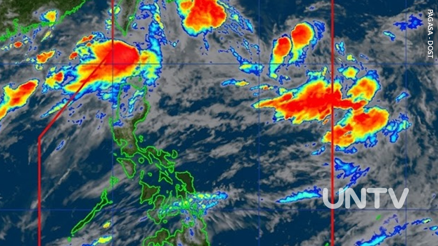
MANILA — Tropical Depression Pilandok may strengthen into a tropical storm within the next 12 hours, according to the Philippine Atmospheric, Geophysical and Astronomical Services Administration (PAGASA).
In its 5AM bulletin Tuesday, September 1, PAGASA said Pilandok maintained maximum sustained winds of 55 kilometers per hour near the center and gustiness of up to 70 kph.
The tropical depression was located about 1,050 kilometers east of Extreme Northern Luzon and was moving west-northwestward at 10 kph.
No Tropical Cyclone Wind Signal has been raised over any part of the country.
PAGASA said Pilandok remains unlikely to make landfall and is expected to stay far from the Philippine landmass. The weather bureau earlier said the cyclone could exit the Philippine Area of Responsibility by Wednesday afternoon or evening, although its forecast track may still change.
Despite Pilandok remaining far offshore, the Southwest Monsoon or Habagat will continue to affect large parts of the country.
Strong to gale-force gusts are expected over most of Luzon and the Visayas, as well as parts of Mindanao including Zamboanga del Norte, Misamis Occidental, Lanao del Norte, Misamis Oriental, Camiguin, Dinagat Islands, Davao Occidental and Davao Oriental.
A gale warning is also in effect over the northern and western seaboards of Northern Luzon.
Heavy rains due to the Habagat are expected over Ilocos Norte, Ilocos Sur, La Union, Pangasinan, Batanes, Abra, Benguet, Zambales and Bataan.
PAGASA advised residents in areas vulnerable to flooding and landslides to remain alert and monitor local weather advisories.






















.jpg)