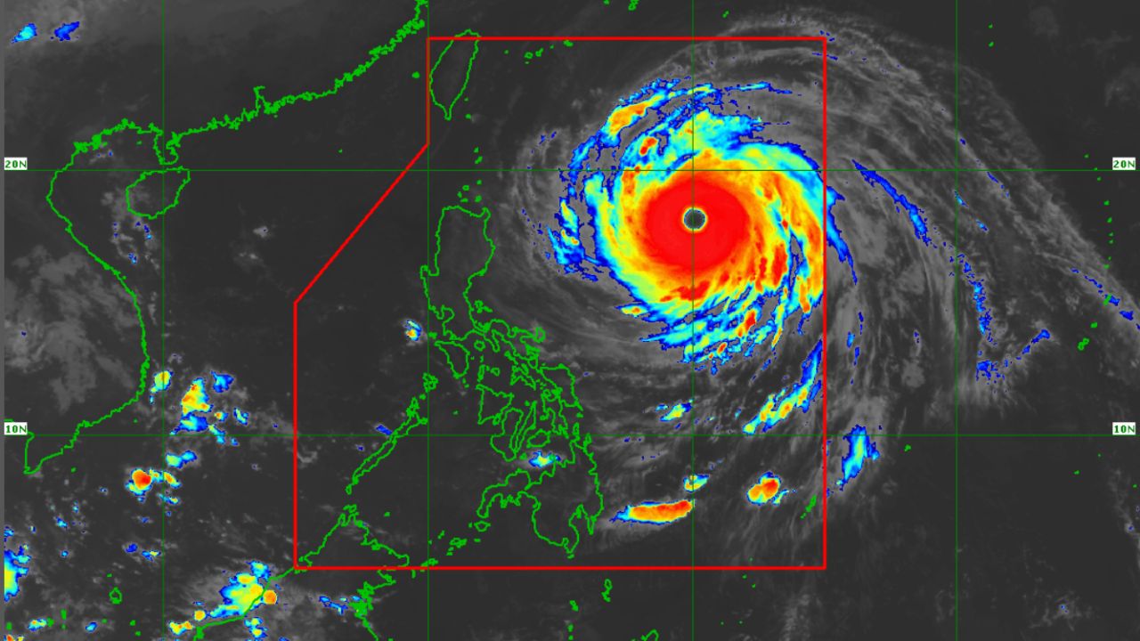
MANILA, Philippines — Super Typhoon Rosal continues to lose strength as it approaches Extreme Northern Luzon, but residents in affected areas remain at risk from strong winds, heavy rainfall, and dangerous sea conditions, according to PAGASA.
In its latest 11 a.m. bulletin on Thursday, October 22, the state weather bureau reported that Rosal's maximum sustained winds had decreased to 185 kilometers per hour (km/h), with gusts of up to 230 km/h.
The storm was located approximately 400 kilometers east of Basco, Batanes, moving west-northwestward at 20 km/h.
Earlier at 5AM, Rosal had maximum sustained winds of 195 km/h and gusts of 240 km/h.
Wind signals remain in effect
Despite the weakening, Tropical Cyclone Wind Signal No. 2 remains raised over Batanes and the northeastern portion of the Babuyan Islands.
Meanwhile, Signal No. 1 is in effect over the rest of the Babuyan Islands, mainland Cagayan, eastern Isabela, Ilocos Norte, and Apayao.
PAGASA warned that strong winds could damage vulnerable structures, while continued rainfall may trigger flooding and landslides in susceptible communities.
Batanes is expected to experience stormy conditions, while Ilocos Norte, Apayao, Cagayan, and Isabela may receive rains accompanied by gusty winds.
PAGASA forecasts Rosal to make its closest approach to Extreme Northern Luzon between Thursday afternoon and Friday morning, October 23, before gradually turning northward.
The super typhoon could weaken into a typhoon within Thursday and leave the Philippine Area of Responsibility by Friday evening or early Saturday, October 24.
A gale warning also remains in effect along the northern and eastern seaboards of Luzon, with waves potentially reaching 12 meters along the northern and eastern coasts of Batanes.
Residents and local disaster response offices are advised to monitor succeeding weather bulletins and follow evacuation instructions when necessary.