%201.svg)


MANILA, Philippines — The public is encouraged to check whether their homes and communities are susceptible to flooding or landslides as the southwest monsoon, or habagat, and a low-pressure area bring heavy rains to parts of the country.
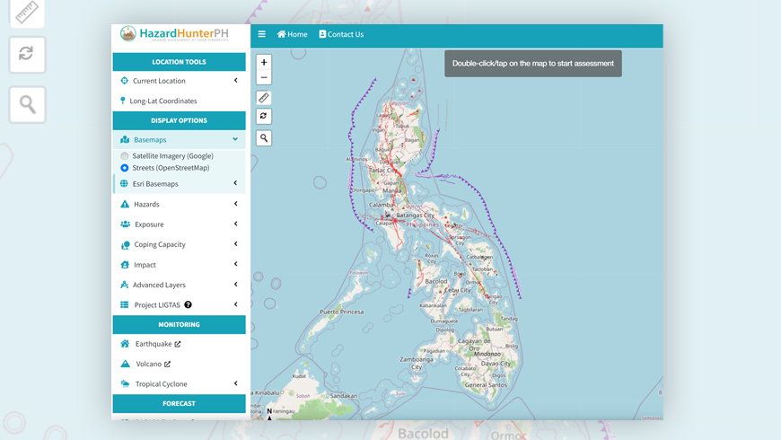
Residents may use HazardHunterPH, a government platform that provides location-specific assessments for seismic, volcanic and hydrometeorological hazards.
To check a location, visit the HazardHunterPH website and select “Use Current Location.” Users may then scroll through the assessment results and look for “Flood (MGB)” to view the area’s possible flood level and expected duration.
The “Rain-Induced Landslide (MGB)” section may also be checked to determine whether the selected location is susceptible to landslides.
Users who want to examine other areas may open the map view and choose Hazards, followed by Hydro-meteorological and Flood (MGB). They may also search for a specific location or enter its coordinates.
HazardHunterPH uses information from several government agencies, including the Mines and Geosciences Bureau, PAGASA and PHIVOLCS.
Authorities, however, emphasize that hazard maps are scenario-based references and not real-time predictions. Residents should continue monitoring official weather bulletins and advisories from their local governments, especially during heavy rainfall.